Why the Last Leg of Port of Houston Drayage is the Hardest
When an import container travels thousands of miles across the ocean, its journey is tracked by satellites, logistics software, and sophisticated maritime data. It feels incredibly high-tech, predictable, and smooth.
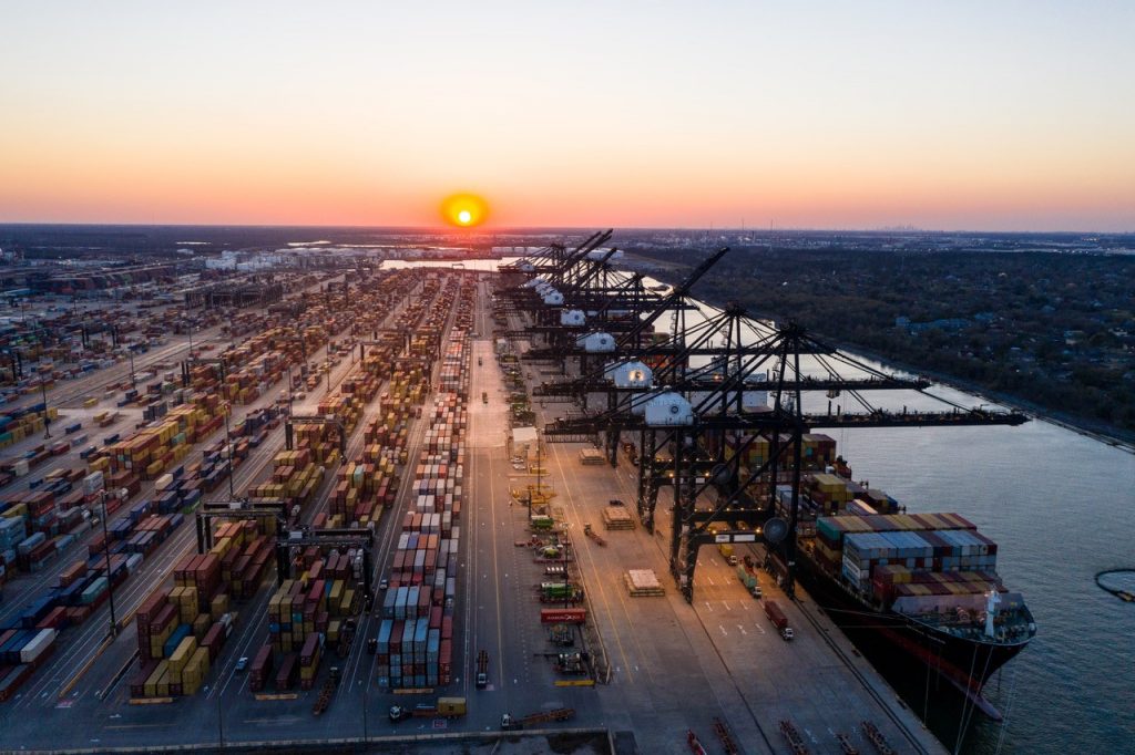
Then, the ship docks at the Port of Houston.
Suddenly, that global supply chain shrinks down to just three critical miles: the high-stakes, hyper-congested stretch of asphalt between the terminal gates of Barbours Cut or Bayport and the open lanes of the local interstate.
Ask any seasoned intermodal driver and they will tell you the same thing: navigating 500 miles of open Texas highway is a breeze compared to surviving the few miles immediately surrounding the port. For out-of-state shippers, this tiny geographic window is where deadlines go to die and unexpected fees are born.
Here is a look at what actually happens in those critical three miles, and why relying on standard GPS or a non-local carrier is a recipe for logistical gridlock.
The Anatomy of the Port Bottleneck
The immediate infrastructure surrounding the Houston terminals is a unique ecosystem. You have a constant influx of heavy class-8 trucks, shifting lane configurations due to regional construction projects, and strict local law enforcement bottlenecks.
 [ Barbours Cut / Bayport Gate ] ──> [ The 3 Critical Miles ] ──> [ Open Interstate (I-10 / I-610) ]
                                            │
                                 • Port Road Congestion
                                 • Hwy 146 Construction
                                 • Sudden Lane Restrictions
Consider the specific pinch points our drivers navigate every single day:
The Highway 146 Puzzle: As the main artery slicing past La Porte, Seabrook, and the industrial complexes, SH 146 is constantly evolving. Ongoing expansion projects, changing detour routes, and sudden lane restrictions mean that a route that worked perfectly on Tuesday could be a complete standstill by Thursday morning.
The Port Road Bottleneck: The stretch leading directly into the Bayport Terminal is a masterclass in heavy traffic coordination. When multiple mega-vessels are discharging containers simultaneously, thousands of trucks converge on this single corridor, turning a two-minute drive into a multi-hour test of patience and defensive driving.
The Weight and Lane Trap: Local law enforcement in the La Porte and Morgan’s Point areas monitor port traffic with extreme precision. If an out-of-state driver drifts into a restricted lane or hasn’t properly verified their tandem axle weight distribution before rolling onto municipal blacktop, they aren’t just getting delayed—they are getting pulled over.
Why Generic GPS Fails the Port Test
Many modern freight brokers sit in offices thousands of miles away, looking at a digital map and assuming that a mile is just a mile. They assign a carrier based purely on a low bid, assuming standard navigation software will guide the driver safely to the destination.
But standard GPS doesn’t know the ports.
It doesn’t know that a specific intersection near the rail lines gets backed up for forty minutes when a freight train cuts through at peak gate hours. It doesn’t know which specific turn-offs are entirely inaccessible for a truck pulling a heavy 40-foot container on a tri-axle chassis.
When a non-local driver gets caught in the wrong lane or misses a critical port entrance cue, they can’t just make a quick U-turn. They are often forced into miles of backtracking, missing their strictly scheduled gate appointment window and forcing the shipper to pay for a wasted dry-run fee.
The Seashore Advantage: True Local Intimacy
Because Seashore Transportation is physically located right next to the action in La Porte, our drivers don’t need a navigation app to tell them how to handle Port Road or Highway 146. We live here.
1. Real-Time Human Intelligence
Our dispatchers and drivers communicate continuously. If a gate lane at Barbours Cut goes down or an accident creates a bottleneck on a specific access road, our fleet is rerouted before they even start their engines. We bypass the gridlock while other trucks are still stuck in it.
2. Strategic Staging
We know exactly how to time our terminal runs to avoid peak congestion windows. By orchestrating our daily drop-and-hook operations around the natural rhythm of the port’s shift changes and lunch hours, we keep our turn-times low and our efficiency high.
3. Absolute Compliance
We know every local weight restriction, bridge clearance, and municipal ordinance by heart. When a Seashore asset pulls a container through those three critical miles, it is completely legal, properly permitted, and fully prepared to clear any local commercial checkpoint without a hitch.
Don’t Let the Last Mile Ruin the First Thousand
Your freight shouldn’t survive an entire ocean voyage only to get stuck three miles short of the highway. By partnering with an asset-based, family-owned carrier that treats the Port of Houston as our personal backyard, you ensure that the final, most chaotic leg of the journey is handled with absolute precision.
Let Seashore Transportation manage the critical miles so you can focus on growing the rest of your business.
Seashore transportation is a transportation staple in La Porte Texas.